
Underground Utility Conflicts: The Excavation Risk Nobody Budgets For
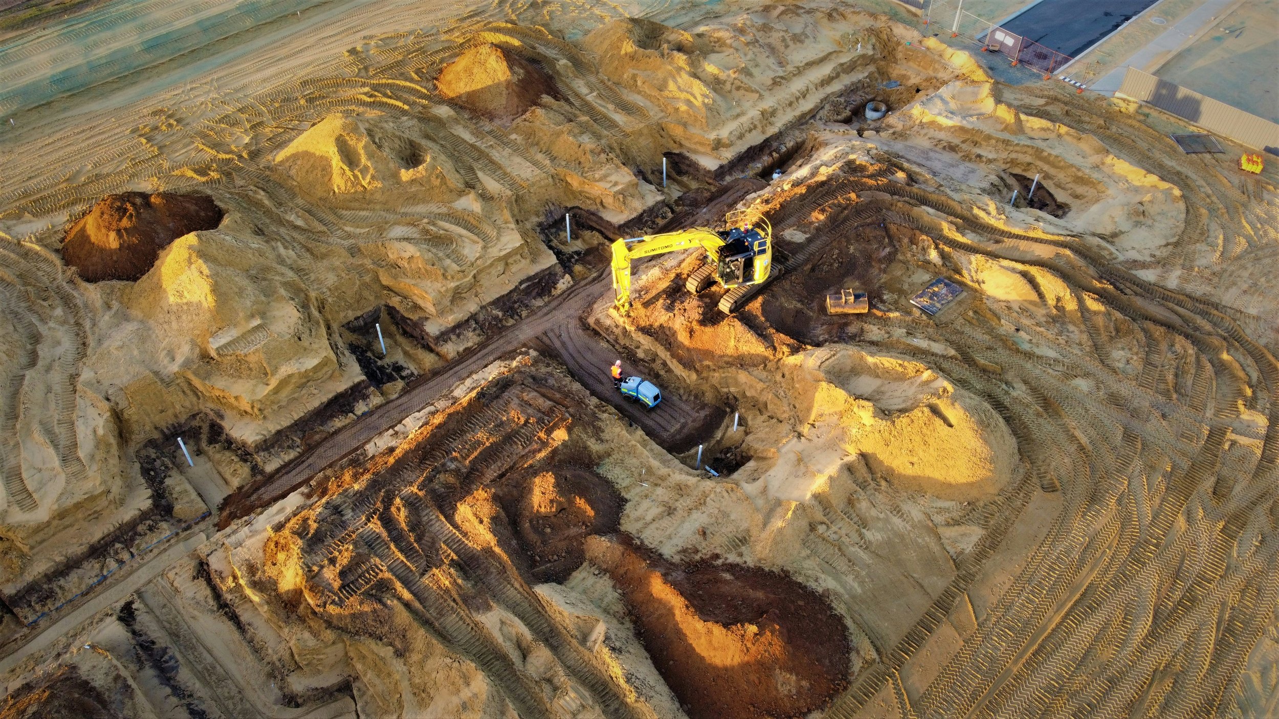
Every year, somewhere between 400,000 and 800,000 times, a piece of excavation equipment makes contact with an underground utility line that was supposed to be out of the way. Gas pipes rupture. Fiber optic cables are severed. Water mains crack. Power lines are clipped. Some of these incidents are minor inconveniences. Some destroy project schedules and budgets. And some kill people.
The combined annual cost of these strikes, in repair bills, project delays, liability claims, and service disruption, is estimated at $62 billion per year. Industry data suggests that 63 to 75 percent of utility damage incidents are preventable with proper planning and field procedures. That gap between what's happening and what's possible represents an enormous amount of avoidable cost and risk on construction projects across the country.
This post covers why the problem is larger than most people on the development side realize, what the 811 system does and doesn't protect you from, what Subsurface Utility Engineering is and how it works, what the four quality levels mean in practice, and what developers, contractors, and project owners need to understand to protect their projects and their people.
1. The Scale of the Problem
The 811 system, also known as Call Before You Dig, is the mechanism by which excavators notify utility companies before they dig, giving those utilities the opportunity to mark the location of their facilities with paint or flags. All 50 states have some version of excavation notification law requiring this. When it works correctly, contractors know where public utility lines are before they dig, and they avoid them.
When it doesn't work, things go wrong in predictable ways. The most common failure modes are: contractor fails to call 811, or calls too late; utility company fails to mark its facilities before the excavation deadline; marks fade or get displaced before excavation reaches the area; contractor digs outside the marked tolerance zone and still hits a line; and most significantly, the utility at risk is private, abandoned, or otherwise not in the 811 system.
That last failure mode is the one that catches the most projects off guard. Approximately 60 percent of subsurface infrastructure in the United States is privately owned and not included in the 811 system. That includes on-site power distribution, fiber optic networks serving individual facilities, private water service lines, and privately owned gas lines. An additional fraction of public utilities are old enough or were installed informally enough that their records are inaccurate or nonexistent. Industry estimates suggest that roughly 65 percent of underground utilities nationwide remain undocumented in reliable mapping systems.
$62 billion
The estimated annual cost of underground utility strikes in the United States, including repair costs, project delays, liability, and service disruption. 63 to 75 percent of these incidents are preventable.
2. What 811 Does and Doesn't Cover
Calling 811 before excavation is legally required and essential. It's also not sufficient on its own for most projects with meaningful excavation depth or complexity.
811 marks the approximate horizontal location of public utility facilities to within a certain tolerance, typically defined by state law as a strip 2 to 4 feet on either side of the marked centerline. It doesn't provide depth information. It doesn't guarantee accuracy to within the tolerance zone. And as discussed above, it doesn't cover private utilities.
The limitations become critical in a few common scenarios. An urban infill project where the subsurface has been disturbed and re-disturbed over decades has layers of utilities from different eras, some mapped, some not. A site with former industrial use has private utility networks that served that use and may still be energized or pressurized. A road widening project crosses dozens of utility corridors, some of which have locating records that are 30 years old and were never updated when the utilities were relocated.
Notification failure accounts for about 26 percent of utility strikes nationally, meaning excavators who either didn't call 811 or didn't wait for all utilities to respond before digging. But the other 74 percent happen despite proper 811 notification, because the system's inherent limitations allow strikes even when everyone followed the required process.
3. Subsurface Utility Engineering: Going Beyond 811
Subsurface Utility Engineering, or SUE, is a discipline within civil engineering that systematically identifies, locates, and maps underground utilities using a combination of geophysical methods, record research, and direct physical verification. ASCE 38-22, the Standard Guideline for Collecting, Depicting, and Classifying the Location of Subsurface Utility Facilities, defines four quality levels that describe the confidence level of utility location data.
Quality Level D: Existing records only. Utility information is gathered from available maps, drawings, and records without any field verification. This is the starting point for any project, but it reflects whatever accuracy the records contain, which for old or private utilities may be very low.
Quality Level C: Survey of visible surface features. Utility information from records is supplemented by field observation of surface evidence: valve boxes, manholes, meters, pole locations, and other visible indicators of what's underground. This improves accuracy but still doesn't verify location within the ground.
Quality Level B: Geophysical methods applied. Ground-penetrating radar, electromagnetic induction locators, and other geophysical techniques are used to designate the approximate horizontal location of underground utilities. 811 marks are at approximately Quality Level B for public utilities when the utility responds to the locate request.
Quality Level A: Physical verification by potholing. A small excavation, typically using vacuum or hydro excavation to avoid damaging the utility, exposes the top of the facility and allows precise three-dimensional location measurement. This is the highest confidence level: the surveyor has actually seen and measured the facility.
The ROI on SUE investment is well documented. Industry data shows that every dollar spent on subsurface utility engineering returns $4.62 in avoided costs on construction projects, primarily through reduced utility strike repair costs, fewer project delays, and the ability to design around utility conflicts before breaking ground. Projects that discover a utility conflict during design spend thousands of dollars resolving it. Projects that discover the same conflict during construction spend tens or hundreds of thousands.
ASCE 38-22 Is Now Mandatory on Many Municipal Projects
The 2022 update to ASCE 38-22 strengthened its status as the governing standard for subsurface utility data quality. Many municipal agencies, state DOTs, and federally funded transportation projects now require ASCE 38-22 Level A or Level B designations for critical utility corridors before design can be finalized. FHWA encourages SUE on all federal transportation projects and allows federal funds to cover the work. For private development projects, the decision to invest in SUE is a project-by-project judgment call, but on any project with significant excavation depth in a developed area, the case for at least Level B designation on critical utility corridors is usually straightforward from a risk management standpoint.
4. The Tools Engineers Use
The geophysical toolkit for utility locating has expanded significantly in the past decade, giving engineers better options for different site conditions and utility types.
Ground-penetrating radar (GPR): GPR sends radar pulses into the ground and detects reflections from buried objects. It can locate metallic and non-metallic utilities, voids, and other subsurface features. GPR works best in dry, sandy soils and degrades in wet clay soils, which attenuate the radar signal. Modern GPR systems can scan a lane of pavement in real time from a vehicle, generating a continuous subsurface profile.
Electromagnetic (EM) induction locators: EM locators apply a signal to metallic utilities, either through direct connection or inductive coupling, and trace the resulting electromagnetic field from the surface. They're highly effective for metallic pipes and cables but can't directly detect non-metallic utilities. Most public utility locating under 811 uses EM methods.
Vacuum and hydro excavation: Vacuum excavation uses high-powered suction to remove soil and expose utilities without physical contact. Hydro excavation adds a pressurized water jet to break up harder soils before vacuuming. Both methods allow Quality Level A verification without the mechanical cutting risk of backhoe excavation. Hydro vac trucks have become increasingly common on projects in developed areas precisely because they allow utility exposure without the strike risk.
Digital twin and 3D utility mapping: Increasingly, SUE data is being incorporated into digital project models that show utilities in three dimensions alongside proposed construction elements. This allows designers to visualize utility conflicts in the design model before construction begins, rather than discovering them in the field. The combination of accurate field data and 3D visualization is changing how utility conflict resolution works on complex urban projects.
5. What This Means for Contractors and Developers
For contractors, the practical message is that calling 811 is the legal minimum, not the risk management standard. On any project with significant excavation in a developed area, allocating budget for SUE Level B designation on critical utility corridors, and Level A potholing at high-risk crossing points and design conflicts, is cost-effective risk management. The OSHA 2025 fines for willful violations of excavation safety requirements are $165,514 per violation, with failure-to-abate penalties of $16,550 per day. Those numbers change the risk calculus compared to the cost of a few hours of vacuum excavation.
For developers and project owners, the message is to verify that SUE is in the scope of services on any civil engineering contract for a project with significant excavation in a developed area. Many standard engineering service agreements don't include SUE unless it's specifically scoped. The project owner who doesn't ask the question may find out that it wasn't included at the moment a utility is struck, which is the worst possible time to discover the gap.
Conclusion
Underground utility strikes are predictable, expensive, sometimes deadly, and mostly preventable. The gap between the frequency at which they occur and the frequency at which they need to occur reflects a systematic underinvestment in subsurface utility identification and verification on construction projects across the country.
The tools to do better are available and increasingly affordable. The standard that defines how to apply them systematically, ASCE 38-22, is widely adopted. The return on investment for SUE is well documented. The question for every project team is whether the investment in knowing what's underground is in the budget from the beginning, or whether the project will discover it on its own when something goes wrong.
