
Landscape Engineering for Flood-Prone Subdivisions: Integrating WSUD Principles Into Site Design
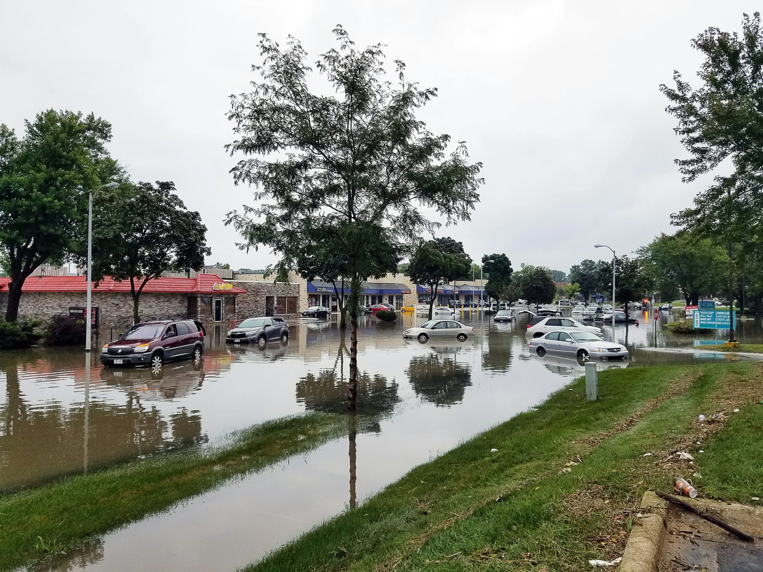
Flood damage to residential property in the United States costs billions of dollars annually. FEMA flood maps, which designate which areas are within the 100-year floodplain, are being revised across the country to reflect updated hydrology, and many areas that were previously outside the designated flood hazard area are being pulled in as the maps catch up with observed flood conditions. ASCE 24-24, the current standard for flood-resistant design and construction, has raised freeboard requirements, meaning that finished floor elevations in designated flood zones need to be higher above the base flood elevation than they used to.
At the same time, the stormwater infrastructure that is supposed to manage runoff from new development is failing to keep pace. Subdivisions built on previously undeveloped land are adding impervious surface and contributing peak runoff flows that overwhelm the drainage systems of both the new development and the communities downstream. The conventional response, bigger pipes, larger detention basins, more concrete channel, simply moves the flood problem downstream rather than solving it.
Water Sensitive Urban Design, or WSUD, is a design philosophy that has been developed most extensively in Australia and is increasingly being applied in the United States. Its core principle is that the site should be designed to mimic the hydrological behavior of the pre-development landscape as closely as possible: allowing rainfall to infiltrate where it falls, slowing runoff before it leaves the site, treating stormwater as a resource rather than a waste product, and designing the landscape to perform these functions as an integrated system rather than as a set of separate stormwater management facilities.
This post covers what WSUD principles look like in practice for subdivision design, how they interact with FEMA flood requirements and MS4 stormwater permits, and what developers, engineers, and homeowners building or buying in flood-prone areas need to understand.
1. Why Conventional Subdivision Stormwater Design Fails Downstream Communities
Here's what typically happens in a conventional subdivision development. The site is graded, vegetation is removed, impervious surfaces are installed, and stormwater is collected in inlets and piped to a detention basin at the lowest point of the site. The detention basin attenuates the peak flow, releasing it at a controlled rate intended to match the pre-development flow. In theory, no net increase in peak discharge reaches downstream communities.
In practice, several things undermine this outcome. The detention basin is designed for the 100-year storm in the current design condition, but as the watershed continues to develop upstream over the coming decades, the cumulative peak discharge from multiple developments exceeds what the detention basin was sized for. The detained volume, even when released at a controlled rate, adds to the total volume of runoff reaching downstream channels over a longer period, producing flooding not at the peak but during the extended recession. And the water quality of detained runoff, even after settling, is substantially worse than the water quality of pre-development runoff that was filtered through soil and vegetation.
WSUD addresses these failures by focusing on reducing the total volume of runoff at the source, not just managing the peak flow from a single site in isolation.
2. WSUD Principles Applied to Subdivision Design
Minimize the impervious footprint
The most effective stormwater control is impervious surface that was never built. Every square foot of impervious surface that gets replaced with vegetated ground cover, permeable pavement, or preserved natural area is a square foot that doesn't generate runoff requiring management. Subdivision layouts that minimize road width, use narrower lots with smaller impervious setbacks, consolidate impervious surfaces to allow larger connected pervious areas, and preserve drainage corridors as natural open space rather than filling and grading them produce less stormwater impact than conventional layouts of similar density.
This is a site layout decision, not a stormwater engineering decision, which is why WSUD requires the landscape and stormwater engineers to be engaged during the site planning phase rather than after the layout is fixed. A site layout that was developed without stormwater thinking is much harder and more expensive to retrofit with WSUD elements than one designed with them from the beginning.
Use the natural drainage system
Most development sites have natural drainage corridors, low areas where water naturally concentrates and moves during rainfall, that were functioning as part of the watershed's hydrological system before development. The conventional development approach fills these corridors, grades over them, and replaces them with engineered pipes and channels. WSUD preserves them wherever possible and treats them as landscape assets rather than obstacles.
A natural drainage corridor preserved as an open green space within a subdivision serves multiple functions simultaneously. It conveys runoff at natural velocity with natural detention and infiltration. It provides riparian habitat. It functions as a trail and open space amenity. And it represents an ongoing water quality treatment function that a pipe cannot replicate. Preserving a natural drainage corridor is almost always cheaper than replacing it with engineered infrastructure, and the preserved corridor performs its hydrological functions for the life of the development without maintenance costs.
Direct runoff to vegetated areas first
Instead of routing rooftop and driveway runoff directly to inlets and pipes, WSUD site design directs it to vegetated areas first. Downspouts that drain to swales or planted areas rather than to impervious driveways and sidewalks. Driveway grades that direct runoff to adjacent planted strips rather than to the street. Rear yard grading that creates ponding areas where runoff accumulates and slowly infiltrates rather than channeling quickly to a collection system.
This approach reduces the volume of runoff reaching the storm collection system, reduces the pollutant load in that runoff through biological filtration in the root zone, and keeps water on-site longer, which supports plant health during dry periods and contributes to groundwater recharge.
Rain gardens and bioretention at the lot scale
Individual lot rain gardens are the residential-scale application of bioretention: a shallow planted depression in the yard, sized to capture and infiltrate runoff from the home's rooftop and impervious areas, planted with plants that tolerate periodic inundation and extended dry periods between rain events. A properly sized rain garden for a typical residential lot can capture and infiltrate the first inch of rainfall from the roof and driveway.
The challenge with lot-scale rain gardens in subdivision design is maintenance: once the home is sold, the homeowner may not understand or prioritize the maintenance requirements of the stormwater facility on their property. WSUD subdivision design increasingly uses HOA-owned common area bioretention facilities that handle runoff from multiple lots, with professional maintenance funded through HOA fees, in combination with individual lot design features that reduce runoff generation.
FEMA Flood Maps and What They Don't Show
FEMA's National Flood Insurance Program flood maps designate the 100-year floodplain as the Special Flood Hazard Area. These maps are based on hydrology calculated for the watershed at the time of the study. In a watershed that has continued to develop since the map was last updated, the actual 100-year flood elevation may be higher than the mapped value. Map revisions are underway across the country, and many areas that were previously outside the SFHA are being mapped in. Before purchasing property near a watercourse or in a low-lying area, it's worth checking whether a map revision is underway that might affect flood zone designation.
3. How FEMA and Stormwater Permit Requirements Interact
Subdivision development in or near flood hazard areas has to navigate two separate but interacting regulatory frameworks: FEMA flood requirements and NPDES stormwater permit requirements. Understanding how they interact helps developers design more efficiently.
FEMA flood requirements: ASCE 24-24 and freeboard
ASCE 24-24, Flood Resistant Design and Construction, is the current standard for buildings in flood hazard areas. It specifies minimum elevations for the lowest floor of residential structures in SFHA zones, along with construction and material requirements for foundations and wall assemblies below the design flood elevation. Critically, ASCE 24-24 establishes freeboard requirements: the additional height above the base flood elevation that must be provided to account for uncertainty and the potential for floods exceeding the mapped 100-year event.
The landscape design interacts with flood requirements in several ways. Finished grade around foundation walls must be designed so that water drains away from the structure and so that the foundation elevation is achieved and maintained. Fill placed to raise the site above the base flood elevation can affect the surrounding floodplain and may require a FEMA Letters of Map Amendment or Revision to formalize the changed conditions. Drainage design on sites with FEMA requirements needs to account for flood stage conditions, not just normal stormwater events.
MS4 stormwater permits: post-construction requirements
Most subdivision development above a threshold site size, typically one acre in most MS4 jurisdictions, triggers post-construction stormwater management requirements under the applicable NPDES stormwater permit. These requirements typically include water quality treatment of the first inch of runoff, peak flow control to maintain pre-development rates, and in many jurisdictions, volume reduction targets that can only be met with infiltration-based green infrastructure.
The combination of flood elevation requirements and stormwater volume reduction requirements creates a design constraint that landscape and civil engineers have to navigate carefully. You can't fill a site to get above the base flood elevation and then expect the filled site to infiltrate stormwater at pre-development rates, because fill material rarely has the infiltration capacity of native soil. The WSUD design challenge on flood-affected sites is achieving the necessary elevation for flood protection while preserving or creating adequate pervious surface for LID stormwater management.
4. What This Means for Homeowners and Buyers
If you're buying a home in a subdivision that was developed in the past 20 years, understanding the stormwater management approach used on the site and in the subdivision tells you something about the long-term flood and drainage performance you can expect. Subdivisions designed with natural drainage corridors preserved, lot-scale and common-area bioretention facilities, and limited impervious surface typically perform better in flooding events than conventional subdivisions with full grading and piped drainage.
The property-level indicators to look for are straightforward. Does the yard drain away from the foundation? Are there rain gardens or bioretention areas in the common areas? Does the neighborhood have natural open space along its drainage corridors? Is the subdivision outside the FEMA Special Flood Hazard Area, and has the map been updated recently enough to reflect current watershed development conditions?
For properties in or near flood zones: understanding whether flood insurance is required (it is for federally backed mortgages on properties in the SFHA), what the current premiums are, and whether the flood map is current is basic due diligence before purchase. FEMA's Flood Map Service Center provides current and pending flood map status for any address in the country.
Conclusion
Subdivisions designed with WSUD principles, that preserve natural drainage, minimize impervious surface, direct runoff to vegetated areas, and use lot-scale and common-area green infrastructure, perform better in flooding conditions and impose less burden on downstream communities than conventionally designed subdivisions of similar density. The engineering tools to design this way exist and are well-established. The regulatory framework increasingly requires elements of this approach through MS4 stormwater permits. What's needed is landscape and civil engineering that integrates stormwater thinking into site design from the beginning rather than treating it as a compliance exercise at the end.
